Annotated Bibliography
For my capstone project, I have chosen to pursue creating an effective way for UAS to be used in accident reconstruction, either aviation or vehicular. I believe that UAS can be a very effective tool for gathering data at a crash site providing high accuracy and quick results. For this project, I conducted some introductory research which is outlined by the annotated bibliography below.
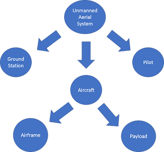
The main goals of this research were A) if this had been done before, B) if so, what are some of the different ways of going about it, C) can off-the-shelf aircraft be used effectively?
Another part of this was to create a research timeline. This will be important in maintaining proper scheduling of flights and research so that I do not fall behind. Indiana winters are extremely variable so I did not plan out specific dates for flights to be completed, however I provided general date ranges that can still be achieved. Ideally I will be able to run test flights in the early months of the winter, but if not I will need to load down heavy on flights towards the end of the semester.
Provided below is a research timeline outlining my goals for the semester project. This timeline is subject to change as the semester
progresses forward. Ideally, I would like to fly more than three test flights
throughout the semester, because the more test flights I am able to get in the better
I will be able to refine my procedure. As was stated in the introduction,
Indiana weather is unforgiving during the early winter months. I may get behind
on my flights at some point in the semester because of this, so I have given
ample time in between deadlines for me to get other flights in before the
deadlines come.
_________________________________________________________________________________
Overall, I believe that this project is very doable within the given time frame. Given great weather conditions I will be able to get in a large amount of flight testing, or if the weather is bad that gives me more time for lab and data work. The literature I have read indicates that this type of project can be done, and I have been given some ideas on where to start because of this. With the resources I have available I do not believe I will be able to do much with aircraft crashes, but setting up a fake car crash scene is doable with a large enough space. One possibility to replicate an aircraft crash is for someone to drop a target in the middle of the field and I will attempt to find it.
The main goals of this research were A) if this had been done before, B) if so, what are some of the different ways of going about it, C) can off-the-shelf aircraft be used effectively?
Another part of this was to create a research timeline. This will be important in maintaining proper scheduling of flights and research so that I do not fall behind. Indiana winters are extremely variable so I did not plan out specific dates for flights to be completed, however I provided general date ranges that can still be achieved. Ideally I will be able to run test flights in the early months of the winter, but if not I will need to load down heavy on flights towards the end of the semester.
Annotated
Bibliography
"Accident Reconstruction and Drone Applications."
Unmanned Systems Source. October 13, 2017. Accessed November 14, 2018. https://www.unmannedsystemssource.com/accident-reconstruction-drone-applications/.
- · A test was run at a head-on collision between two cars in North Carolina. One team was the State Highway Patrol Collision Reconstruction Unit, and their measurements were completed in 1 hr. 51 minutes. Another team was the Division of Aviation UAS flight team, which surveyed the same area but they completed their work in 25 minutes. The specialized flight planning software used requires less specialized training for capturing the data, however this does not mean that there is less specialization required for the analysis of the data.
Bateson, Mark. “Here we explore this aerial technology and
understand what’s involved to use these new tools”. Aerial Perspective.
Accessed November 14, 2018
- · Air space restrictions are worth noting depending on where you are flying. However, public agencies can acquire COAs to allow them to work around these restrictions. The specialty does not come in the flights themselves, but rather processing the data post-flight. Flying the aircraft is a minimal part and the aerial flights are not difficult, can train someone on the aircraft in just a few days. This article states that aircraft regulations are “nothing more than a paperwork hurdle” and can be overcome easily to keep flying. However, I disagree with this, as the FAA can oftentimes be slow about reaching out about an approval request. This article touches on the importance of payload on your aircraft, however it does not mention that altitude flown is mainly what determines GSD.
"CAN DRONES HELP FOR ACCIDENT INVESTIGATION
TASKS?" Pixprocessing. September 24, 2018. Accessed November 14, 2018. https://pixprocessing.com/can-drones-help-for-accident-investigation-tasks/.
- · There are multiple areas where UAVs can be used to enhance scene collection procedures. For car accidents, you can gather aerial data quickly for reconstruction to be done back at the lab. Using UAVs for air accidents can be different than a car accident because the debris is scattered over a much larger area. The debris field could stretch miles across, and by using a UAV, you can fly along certain stretches looking for pieces of the wreckage. The Malaysian airlines crash utilized both UAV and UWVs to find parts of the wreckage. Marine accident investigation can span a larger area than both car and air. The pieces of the wreckage may float away or begin to sink, causing the reconstruction to be much more difficult. Drones can be used to address the current situation as well as provide progress reports during the cleanup stages
DroneDeploy. "Transforming Accident Investigation With
Drones – DroneDeploy's Blog." DroneDeploy's Blog. July 23, 2018. Accessed
November 14, 2018.
https://blog.dronedeploy.com/transforming-accident-investigation-with-drones-edec7162d8ce.
- · According to a 2017 report by Freedonia Group, drone spending by county and municipal governments will reach $80 million by 2025. This article outlines multiple benefits of using UAVs for data acquisition: The flights they conducted mapped out the scene in under 10 minutes, There is increase officer safety in the field because investigators can review the data from their office once the scan is complete, they can get a bird’s eye view of the scene, and can reconstruct imagery/ create markup maps. After a 3D model is created, measurements can be taken in Drone Deploy software. Cloud based storage allows for permanent archival access.
Karpowicz, Jeremiah, Sean Higgins, and Andrew Guillemette.
"How Are Drones Being Used for NTSB Investigations?" Commercial UAV
News. November 07, 2017. Accessed November 14, 2018. https://www.expouav.com/news/latest/drones-used-ntsb-investigations/.
- · The NTSB first got involved with unmanned aircraft in 2006 when they were investigating a MQ-9 predator crash in Arizona. They are able to now use drones to create accurate wreckage diagrams of aviation accidents. They are able to map a runway in half of the time as traditional methods, this allows for shorter down time and airports can resume operations quicker. The amount of money lost by cancelled flights due to shut down runways can decrease drastically, and the airport can resume its operations much faster by using a drone for aircraft accident mapping. The NTSB is also using drones to look for scattered parts of wreckage across large areas of land. They are able to cover wide ranges of land in a short time by flying a drone as opposed to other conventional methods
Manfreda, S., M. E. McCabe, P. E. Miller, R. Lucas, V. P.
Madrigal, G. Mallinis, E. Dor, D. Helman, L. Estes, G. Ciraolo, J. Mullerova,
F. Tauro, M. I. de Lima, Jlmp del Lima, A. Maltese, F. Frances, K. Caylor, M.
Kohv, M. Perks, G. Ruiz-Perez, Z. Su, G. Vico, and B. Toth. 2018. "On the
Use of Unmanned Aerial Systems for Environmental Monitoring." Remote
Sensing 10 (4). doi: 10.3390/rs10040641.
- · Most current data acquisition is done by using ground-based measurement tactics which can be very time and labor intensive. There is a large potential for UAS to break into this market and take over as a main resource for data acquisition, however there are varying obstacles that need to be overcome. There is the need to find the right sensor for the job, as well as find a way to properly mount that sensor to the aircraft. Another difficulty with using UAVs it is imperative to find the right software for the job, as you can either go with open-source or proprietary software. There are advantages and disadvantages to both, some of which have been touched upon in some of my previous blog posts. This report provides a lot of important information for sensor integration and data collection, which will be helpful for future parts of my project. Unfortunately, it does not discuss the specifics of the accident construction, which if I am to develop a proper workflow, is vital information to have.
Michelle M. Mekker, Ph.D., Fangning He, Ph.D., John L.
Bullock, Ayman F. Habib, Ph.D., and Darcy M. Bullock, Ph.D., P.E. “Evaluation of Consumer Grade Unmanned
Aircraft Systems” ite Journal. July 2018. Accessed October 01, 2018.
- · The crash rate during congested conditions is 24 times greater than during uncongested conditions. Of the ~15,000 crashes in Indiana in 2014, 3,448 occurred during congested conditions. This report outlines the general steps they used to document a crash scene with a UAS: Safely secure the scene, Install or apply scaling control markers, Mark critical items that may have reduced visibility in aerial imagery, Measure the distances between the scaling control markers, Identify a safe flying altitude, Plan and fly a mission, and Clear the incident scene. Oblique images can provide situational context, but are difficult to scale and identify common features for ortho-rectification. Therefore, grid patterns are “desirable” because multiple images can be stitched together to form high-resolution images. Lower altitude flights obtain higher resolution images, however the flights take longer. This report presented a procedure for executing UAS missions at the scene, with a maximum observed error from the ortho-rectified images of 2.3cm.
North Carolina Department of Transportation – Division of
Aviation – UAS Program Office. “Collision Scene Reconstruction &
Investigation Using Unmanned Aircraft Systems”. August 2017. Accessed November
14, 2018.
- · This group did crash scene mapped using DJI Mavic Pro, DJI Phantom 4 Pro, and DJI Inspire 2. Their flights were completed in under 25 minutes, and the data processing was completed in 2 hours. Included in this report was their image processing workflow which goes as follows: Add photos to agisoft software, Align images with high accuracy and pair selection, Build a dense point cloud at medium quality and moderate depth filtering, Build mesh on the dense point cloud, Build textures, and Export model for 3D modeling packages. There were 8,547,150 points in this dense cloud. Measurements were within .03 feet. Also, in this report the group used traditional ground mapping methods. The ground mapping was done by a laser scanner, and 106,703,633 points were obtained while taking one hour and 51 minutes to scan. Data processing was processed through a different software and took one hour 58 minutes. Overall, the study concludes that using UAVs for accident reconstruction is 344% more timely than traditional methods, and they argue there is “huge potential for quick and accurate documentation of vehicle collision scenes”. The group states at the end these were done in well-lit and calm conditions, and they plan to test in varying conditions as well as nighttime.
Pix4D. "4 Reasons Drones Will Revolutionize Accident
Scene Response." Pix4D Blog. May 26, 2016. Accessed November 14, 2018. https://medium.com/the-science-of-drone-mapping/4-reasons-drones-will-revolutionize-accident-scene-response-a1db234eeccf.
- · This article argues that drones will make documenting scenes dramatically faster. Current ways of documenting include laser scanners, total stations, and photography, which require personnel training in survey methods. Drew Jurkofsky, a Colorado Police officer stated in a study done by Unmanned Experts that “Using a drone for accident documentation instead of traditional methods cut time spent in the roadway to nearly one fifth and measuring time to around one third.” By reducing time spent on site they lower human and financial costs. This is also an important part of safety because according to the Federal Highway administration (FHWA), every minute an accident continues to be a hazard the chances of an additional accident increase by 2.8%. Traffic related fatalities are the leading cause of officer death, so the less time on the roads, the safer our officers will be. Beyond safety, the measurable outputs from a UAV provide evidence to show in court. The images gathered can be used to create 3D point clouds/models and orthomosaic reports.
Singh, K. K., and A. E. Frazier. 2018. "A meta-analysis
and review of unmanned aircraft system (UAS) imagery for terrestrial
applications." International Journal of Remote Sensing 39
(15-16):5078-5098. doi: 10.1080/01431161.2017.1420941.
- · Remote sensing has expanded to UAVs over the last decade, and its adoption has gone smoothly in the community. However, there is an underlying problem in the relationship between the data collection methods and the data quality. By this, I mean that while we can obtain mass amounts of data at a much more rapid pace, this does not always mean that the data is going to be of the same integrity that ground based remote sensing options can gather. There is a wide range of UAS practices, which ultimately results in a wide range of results, so if there was an established set of practices, then this would help alleviate some of the consistency issues. Hopefully during this capstone I can help identify certain “best practices” that can effectively gather accurate data.
____________________________________________________________________________________
Objective:
|
Deadline:
|
Create initial workflow plan
|
January 22
|
Operate first flight for efficiency testing
|
February 1
|
Analyze flight data (create map, overlay images, etc. [will be
further identified in initial workflow plan]), identify areas for increased
efficiency
|
Febraury 14
|
Round 2 of flight testing
|
February 28
|
Analyze flight data (create map, overlay images, etc. [will be
further identified in initial workflow plan]), identify areas for increased
efficiency
|
March 14
|
Round 3 of flight testing
|
March 28
|
Analyze flight data (create map, overlay images, etc. [will be
further identified in initial workflow plan]), identify areas for increased
efficiency
|
April 11
|
Complete paper with all findings
|
April 18
|
_________________________________________________________________________________
Overall, I believe that this project is very doable within the given time frame. Given great weather conditions I will be able to get in a large amount of flight testing, or if the weather is bad that gives me more time for lab and data work. The literature I have read indicates that this type of project can be done, and I have been given some ideas on where to start because of this. With the resources I have available I do not believe I will be able to do much with aircraft crashes, but setting up a fake car crash scene is doable with a large enough space. One possibility to replicate an aircraft crash is for someone to drop a target in the middle of the field and I will attempt to find it.

Comments
Post a Comment