Posts

Showing posts from October, 2018

McCormick Park Field Outings
Image
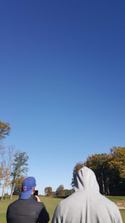
Over the course of the previous two weeks, my classmates and I have engaged in aerial data collection over a forest located 1.7 miles from Purdue University Airport (KLAF). The flights were conducted in conjunction with local air traffic, and approval was received from KLAF for these flights. We went out to fly multiple days and flew various aircraft. There were instances where either: the flight path was not registered by the aircraft, the data was not captured during the mission, or the aircraft would lose signal mid-flight. This caused us to rotate between different aircraft. Since the flight was over a large wooded area, it was difficult for the flight crew to maintain visual line of sight (VLOS) during the operation. To solve this problem, we broke up into three different teams around the perimeter of the woods and maintained radio contact throughout the course of the operation. This "daisy-chain" allowed us to conduct an autonomous flight mission even though the pilot...

UAS Map Creation Lab 2

Introduction * What is GIS? That is, is it just software. What did Dr. Christina Hupy stress when she spoke about what defines what exactly constitutes GIS? A GIS, or geospatial information system is a system that captures geographical data in a certain area. The GIS is more than just the software used to create it, because you need data and a scale to reference the data to. GIS is more related to understanding all of the data as opposed to just the software. * What makes open source GIS (QGIS) different than proprietary (ESRI) GIS? And What are advantages and disadvantages between the two? Open source GIS is created and then developed by the community. People can take the source code and then edit it however they see fit. This is nice for customization options because people frequently release various code updates, however if you want support for said code it may be difficult to get because everything is rapidly changing. Proprietary GIS such as ESRI is developed by a sp...

ArcMap and ArcScene Map Creation

Created map located under 'Figures' Page... * Why are proper cartographic skills essential in working with UAS data? It is very important to be able to show your audience your UAS data in a clear and concise manner. Illustrating a map is a very effective way to do so. It shows your audience the important features of your data set, the direction reference with a compass rose, and even key flight data such as time, date, etc. * What are the fundamentals of turning either a drawing or an aerial image into a map? A drawing/illustration needs a few things to become a map: a scale, a legend, a coordinate system, watermark, and attribute data. If it is missing one or more of these components, then it is technically not a map. A scale and coordinate system give those viewing it some insight into the image they are looking at. A legend explains key features of the map, and attribute data is used to provide key flight information. The watermark is essential in making your dat...

"Predator" Write-Up

Too Honest Abe Abe Karem had been one of Israel’s brightest minds ever since he was born. From tearing apart mechanical objects like old radio stands, to completing mechanical sets and model gliders, his mind developed at a young age. He was also a brilliant inventor, devoting nearly all his time to developing new engineering feats that could push the boundaries of aviation. However, as brilliant a mind he possessed, he oftentimes found himself on the short end of business relations. His tendency to go over his superiors and his impatient tendencies caused rifts throughout his business endeavors that may have ultimately hurt his ultimate success. One of Abe Karem’s shortcomings was his decision to route around his supervisors and go straight to a position of highest authority. When he was in the Israeli Air Force in 1961, he rose very quickly to major and was so well-respected by his peers that he could get the commander in chief on the line when he wanted. This was attributed ...